 Maps of Rocky Mountain National Park
- Enhanced
roadmap of Colorado
- How to drive to RMNP
- Landsat - Satellite image of Rocky Mountain
National Park in color.
- Virtual
reality - Color
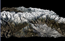
image in 3D of Rocky Mountain National Park
- Rendering - of Rocky Mountain National
Park area in color.
- Rendering - of Rocky Mountain National Park's
Longs Peak area in color.
- Rendering - of Rocky Mountain National Park's
Twin Sister's Peak in color.
- Rendering - of Rocky Mountain National Park's
Mummy Mountain area in color.
- Rendering - of Rocky Mountain National Park's
Mt. Fairchild area in color.
- Rendering - of the Estes Park area in color.
- Topographic
Map - of 14, 256'
Longs Peak in color.
Credits to individual technical contributors
Click Here To Learn More About RMNP
.
"Beyond
here there be Dragons".........( a notation often found on
olde maps )